Estimation of coastal defence functions of salt marshes at the landscape scale.
In the context of increasing coastal population densities, climatic changes and sea level rise, coastal defence is an increasingly important and expensive management problem. Coastal defence is a potentially valuable ecosystem service which is not adequately understood. While there is an increasing recognition among the research community of the potential value of ‘natural’ coastal energy buffers in the form of marshes or reed beds, there has been little practical application of these ideas in coastal defence design. This is largely because the evidence collected to date has been small-scale (ca. 100m) and the variety of conditions observed to date does not represent the high energy storm surge conditions in which the coastal defence function would be most valuable to coastal managers.
The CBESS project seeks to evaluate the coastal defence functions of saltmarsh systems, and the relationships between these functions and measures of biodiversity at a variety of scales. This project aligns well with the CBESS aims of investigating scale dependencies within relationships; it is designed to enable scaling of biophysical measures to the landscape level. The long period over which wave monitoring is proposed may also provide some storm conditions for which it has not yet been possible to instrument a marsh system and evaluate the services provided.
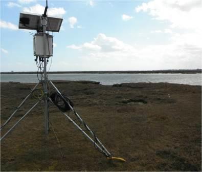
This research aims to produce a model capable of estimating wave attenuation over salt marsh surfaces, under a variety of conditions, based on satellite and aerial dataset inputs. A two-year dataset of water pressure along transects at the margins of two UK salt marshes will be used to reconstruct wave conditions and calculate energy absorption by the salt marsh vegetation. Seasonal field measurements will also be undertaken to evaluate the characteristics of the vegetation in terms of height, density, biomass, vertical structure and species composition. Field spectroscopy and terrestrial laser scans will be carried out to provide ancillary and validation data.
Relationships will initially be sought between wave attenuation and vegetation characteristics measured in the field, building on the work of CBESS. A model will then be developed to integrate airborne field data with aerial and satellite observations, with particular emphasis on Sentinel 2 datasets.
This system will then be used to investigate the potential for remotely-sensed datasets to be used to estimate relevant attriburtes of salt marshes, and thereby infer coastal defence functions. Of particular interest will be the nature of tradeoffs between the different sensor platforms and the scales at which they permit evaluation of system processes.
It is hoped that the resulting tool will enable easier estimation of coastal ecosystem services in the context of management and planning, while also addressing questions about the viability of using remotely sensed products to extrapolate processes which operate at scales down to individual plant stems.