For more information read Ben’s non-technical summary.
January 2014
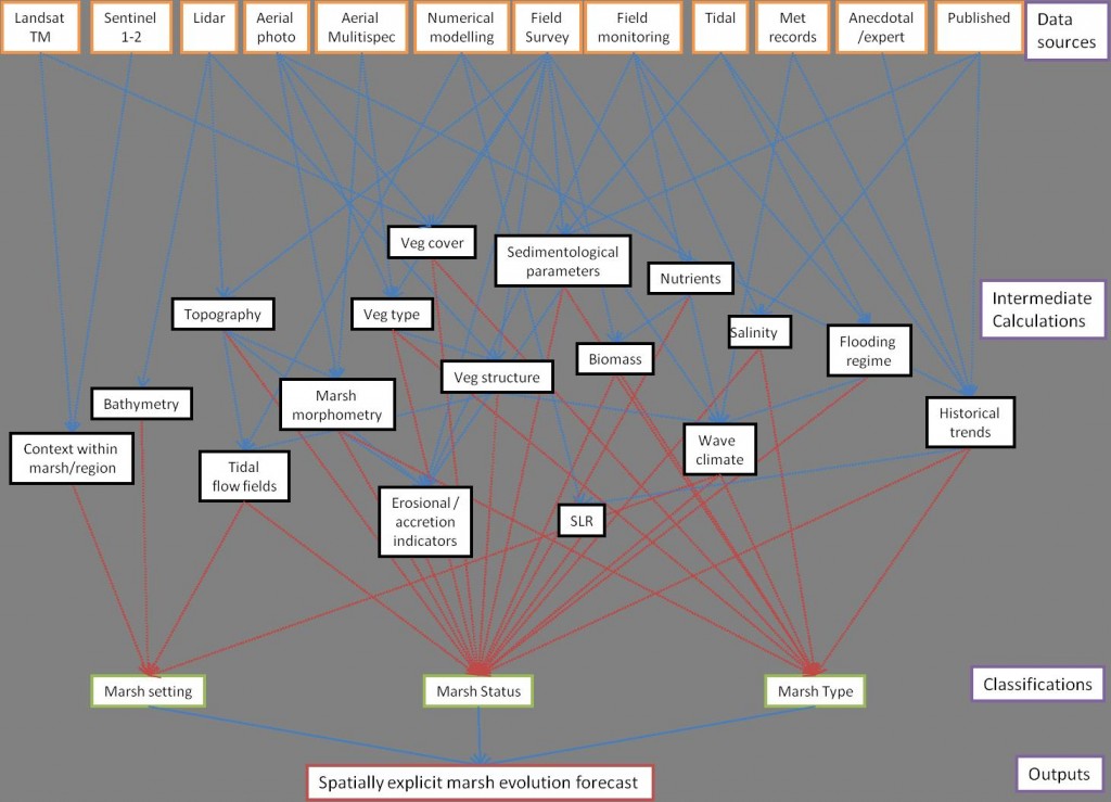
The structure of my PhD plans have changed somewhat, since the summary I provided for the Autumn Newsletter. Having been initially thinking along the lines of relating airborne and satellite observations to biophysical parameters and wave or flow attenuation, I have shifted my focus towards longer-term stability of salt marsh systems. I am looking to synthesise information from remotely-sensed products, field surveys and published sources in an attempt to create spatially-explicit characterisations of marshes on the Essex coast. By using historical trends and time-space substitutions, I hope to be able to make some predictions as to the likely future trajectory of marshes at the hectare scale.
The data synthesis will be conducted within a Bayesian network, which represents a novel approach to evaluation of salt marsh morphological evolution. I hope to produce a data availability driven model which will allow for the interrogation of diverse datasets for specific sites or locations and provide information to site managers on likely future evolution of the system in question, allowing them to make judgements about how and where they can best deploy management and monitoring effort to achieve their site-specific management aims. The Bayesian model for data integration is the core of this work, and will be constructed such that it can be applied within a GIS framework across sites at one hectare grid cells. Conceptually the model looks something like this:
In order to provide a foundation for this work I will be attending a NERC-funded course on Bayesian Methods for Environmental Scientists in February, hosted at the University of Strathclyde.