Coastal protection is an important hazard regulation ecosystem service and measurements of wave energy dissipation over mudflats and salt marsh surfaces have been a key component of the CBESS research programme at field sites in the Essex Estuaries and Morecambe Bay.
However, there remain concerns i) as to just how effective marshes are when it really matters, under extreme water levels and large waves; and ii) how measurements taken over relatively short experimental transects can be ‘scaled-up’ to assess the role of larger assemblages of coastal ecosystems. Looking at extreme water levels on a coastline with a complex nearshore topography and ecology after a storm surge offers possible insights into these larger scale temporal and spatial controls.
The UK east coast storm surge of 5 – 6 December 2013 tested sea defences, damaged infrastructure and locally flooded urban centres and rural communities. The surge was triggered by an intense easterly-tracking cyclonic disturbance across the northern North Sea, accompanied by Beaufort Force 9 (strong gale) to 11 (violent storm) winds. The storm-generated surge, superimposed on high spring tides, propagated southwards along the east coast of Scotland (12:00 noon (UTC) 5 December at Wick) and England (02:00 6 December at Sheerness, outer Thames estuary)1. In modern times, the benchmark for such events has been taken as the storm surge of 31 January – 1 February 1953, arguably, in terms of loss of life (>2000 deaths), the most devastating natural disaster to affect western Europe during the last 100 years. It is clear that, alongside strengthened defences, improved early warning systems and better-integrated crisis management, advances in storm surge forecasting averted a similar catastrophe 60 years later. We return to the issue of forecasting further below.
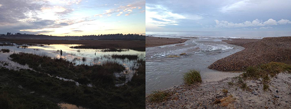
On the days after the surge, we gathered high resolution2 measurements (from clear debris lines, erosional cliffing in earthen embankments and water marks on buildings) of maximum water level elevations around the East Anglian coastline, concentrating in particular on the 45 km shoreline between Holme-next-the-Sea and Salthouse in North Norfolk. Here the surge was accompanied by onshore winds, with wave heights reaching 3.8 m (Blakeney Overfalls Waverider) at the time of peak water levels. Surveys in North Norfolk confirmed that the 5-6 December 2013 event was comparable to, and in places exceeded, 1953 flood levels. Of particular significance, however, was evidence for considerable alongshore variations in mean peak water level heights, with maximum between-station differences of close to 2 m. This variability reflects the combined effect of still water level (tide + surge) and wave runup, which has a strong local component. For this coastline of barrier islands, spits and tidal embayments, these observations point to the critical role played by geomorphic setting (open coast, tidal inlet, backbarrier) and coastal ecosystems (extent of mudflat, saltmarsh) in determining the actual pattern of storm surge impacts. These differences become critical when properties, infrastructure and lives are threatened by sea flooding.

Even improved forecasting models at the present time only provide a general assessments of flood risk at scales of kilometres. This is because they do not adequately incorporate the shallow tidal flats, tidal channels and intertidal marshes that significantly affect surge propagation and thus local patterns of seawater inundation. Similarly, hindcasting from still water level records at widely-spaced tide gauges, often located in deep channels and protected harbours, can only give the broadest regional picture of storm surge impacts. We believe that the findings of these immediate post-event surveys highlight the need to take greater notice of such morphodynamic controls, both in improving hydrodynamic modelling and forecasting efforts and in fine-tuning early warning systems and strategic evacuation planning, in time for when the next ‘big flood’ threatens the vulnerable low-lying coasts of NW Europe.
1. National Tidal and Sea Level Facility
2. Leica Viva GS08 GNSS system; all measurements with 3-D coordinate quality < 50mm, and typically < 20mm.
Tom Spencer, Iris Möller, Ben Evans and James Tempest Cambridge Coastal Research Unit, Department of Geography, University of Cambridge
and
Susan M Brooks Geography, Environment and Development Studies, Birkbeck, University of London